
After the Concrete Dries, an As-Built Survey Captures What Really Happened
Every construction project starts with a plan. Those plans show where the building will go, how big it will be, where the utilities will run, and how everything connects. But by the time the last worker leaves the job site, what was built rarely matches those original drawings exactly.
Foundations shift a little during excavation. Utility lines get moved around obstacles. Walls end up in a slightly different spot than the blueprint showed. These changes are normal and happen on almost every project. The problem is that nobody officially records them unless an as-built survey is ordered.
What Is an As-Built Survey?
An as-built survey is a formal survey done after a construction project is complete. A licensed land surveyor visits the site and measures everything that was actually built. Those measurements are put together into a document that shows the true, final state of the property.
It is not a home inspection. It does not check the quality of the work or whether the construction meets building codes. Its job is simply to measure and record. Where is the building? How close is it to the property line? Where do the utilities run? What are the actual dimensions of the finished structure? The as-built survey answers all of those questions with real, documented numbers.
As-Built Survey vs. Construction Plans
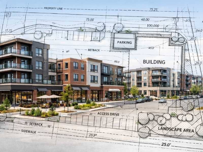
Construction plans show what was intended. An as-built survey shows what actually happened. These two documents can look similar, but the differences between them can matter a lot later on.
If a building ended up two feet closer to the property line than the approved plan showed, the construction plans will not catch that. The as-built survey will. That kind of difference can affect zoning rules, insurance coverage, and future renovation approvals.
Who Prepares an As-Built Survey?
A licensed land surveyor prepares the as-built survey. In the United States, surveyors must hold a license in the state where the property is located. The surveyor uses field measurements, GPS tools, and sometimes LiDAR scanning to record the exact position and size of everything on the site. The finished document is certified and signed by the surveyor, which gives it legal standing.
What Does an As-Built Survey Document?
Structures and Improvements
The survey records the exact location and size of all structures on the property. This includes the main building, garages, retaining walls, driveways, walkways, patios, and fences. Each structure is measured in relation to the property boundaries and required setback lines.
Utilities and Underground Systems
One of the most useful parts of an as-built survey is the mapping of utility lines. Underground utility conflicts are one of the leading causes of delays and damage during future digging or construction work. An as-built survey maps where water lines, sewer lines, electrical conduits, and drainage systems were actually installed, not just where the original plan said they would go.
This information becomes very important years later when a new owner wants to add a structure, dig for landscaping, or make repairs.
Boundary and Setback Verification
The survey also confirms that the finished construction sits within the correct property boundaries and meets all required setbacks. Setbacks are the minimum distances a structure must be from property lines, roads, or other features based on local zoning rules. If a structure was built too close to a boundary line, the as-built survey will show it. Finding that early is much better than discovering it during a future sale or permit application.
Why Do As-Built Surveys Matter?
For Property Owners
An as-built survey gives you a reliable record of your property as it looks today. If you ever sell the property, refinance, or apply for permits for future work, having an accurate document on file speeds things up and reduces the chance of surprise problems.
For Contractors and Developers
Contractors and developers use as-built surveys to properly close out projects. Many local governments across the United States require an as-built survey before they will issue a certificate of occupancy for a new building. Without that certificate, the building cannot legally be used or occupied. Completing the as-built survey is part of finishing the job the right way.
For Future Renovations or Sales
When a future owner or contractor needs to add onto a building, pull new permits, or sell the property, they will need accurate records of what exists. Working from old construction plans that do not reflect what was actually built leads to mistakes, delays, and extra costs. An as-built survey removes that guesswork.
When Is an As-Built Survey Required?
Government and Permit Requirements
Many local governments require an as-built survey before they issue a final certificate of occupancy. This is especially common for new homes, commercial buildings, and projects that involve major grading, utility work, or drainage. Requirements vary by location, so it is a good idea to check with your local permitting office early in the project.
Lender and Title Company Requirements
Construction lenders often require an as-built survey before releasing the final payment on a construction loan. This confirms the work was completed as described and that the finished building matches what was financed. Some title companies also require one before insuring a newly built property.
How Much Does an As-Built Survey Cost?
As-built surveys typically cost between $800 and $2,500 for most homes and smaller commercial projects. The final price depends on the size of the structure, how complex the utility documentation is, and how much detail the permitting office or lender requires.
Larger commercial projects or those needing detailed underground utility mapping can cost significantly more. The more that needs to be documented, the higher the price.